Russia topographic map
Interactive map
Click on the map to display elevation.
About this map
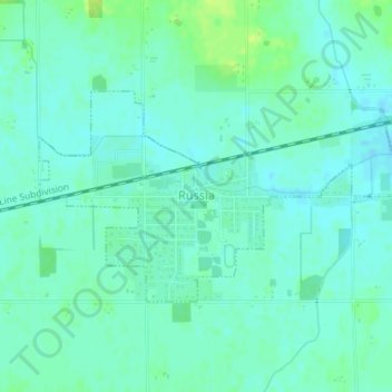
Name: Russia topographic map, elevation, terrain.
Location: Russia, Shelby County, Ohio, United States (40.22640 -84.42405 40.24108 -84.38828)
Average elevation: 978 ft
Minimum elevation: 961 ft
Maximum elevation: 1,007 ft
Other topographic maps
Click on a map to view its topography, its elevation and its terrain.
Lockington
United States > Ohio > Shelby County
Lockington, Shelby County, Ohio, United States
Average elevation: 928 ft
Plattsville
United States > Ohio > Shelby County
Plattsville, Shelby County, Ohio, United States
Average elevation: 1,089 ft
Ballou
United States > Ohio > Shelby County
Ballou, Shelby County, Ohio, 45317, United States
Average elevation: 1,109 ft
Fort Loramie
United States > Ohio > Shelby County
Fort Loramie, Shelby County, Ohio, United States
Average elevation: 958 ft
Sidney
United States > Ohio > Shelby County
Sidney, Shelby County, Ohio, 45365, United States
Average elevation: 1,024 ft
Sidney
United States > Ohio > Shelby County > Sidney > Sidney
Sidney, Shelby County, Ohio, 45365, United States
Average elevation: 1,024 ft
Jackson Center
United States > Ohio > Shelby County
Jackson Center, Shelby County, Ohio, United States
Average elevation: 1,030 ft