
Make a donation
Gear up for your next adventure:
As an Amazon Associate, this site earns from qualifying purchases at no extra cost to you.
Grand Canyon Village topographic map
Click on the map to display elevation.
Make a donation
Gear up for your next adventure:
As an Amazon Associate, this site earns from qualifying purchases at no extra cost to you.
About this map
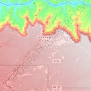
Name: Grand Canyon Village topographic map, elevation, terrain.
Average elevation: 5,466 ft
Minimum elevation: 2,359 ft
Maximum elevation: 7,313 ft
Coconino County trails, hiking, mountain biking, running and outdoor activities
Make a donation
Gear up for your next adventure:
As an Amazon Associate, this site earns from qualifying purchases at no extra cost to you.
Other topographic maps
Click on a map to view its topography, its elevation and its terrain.
Pima Point
United States > Arizona > Coconino County > Grand Canyon Village
Average elevation: 5,007 ft
South Rim
United States > Arizona > Coconino County > Grand Canyon Village
Average elevation: 6,096 ft