
Payson topographic map
Interactive map
Click on the map to display elevation.
About this map
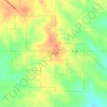
Name: Payson topographic map, elevation, terrain.
Location: Payson, Adams County, Illinois, United States (39.80722 -91.25635 39.82640 -91.23219)
Average elevation: 719 ft
Minimum elevation: 636 ft
Maximum elevation: 781 ft
Adams County trails, hiking, mountain biking, running and outdoor activities
Other topographic maps
Click on a map to view its topography, its elevation and its terrain.