
Fair Play topographic map
Interactive map
Click on the map to display elevation.
About this map
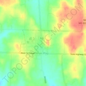
Name: Fair Play topographic map, elevation, terrain.
Location: Fair Play, Polk County, Missouri, United States (37.62905 -93.58292 37.63735 -93.57084)
Average elevation: 1,027 ft
Minimum elevation: 935 ft
Maximum elevation: 1,122 ft
Polk County trails, hiking, mountain biking, running and outdoor activities
Other topographic maps
Click on a map to view its topography, its elevation and its terrain.