
Mineral Wells topographic map
Interactive map
Click on the map to display elevation.
About this map
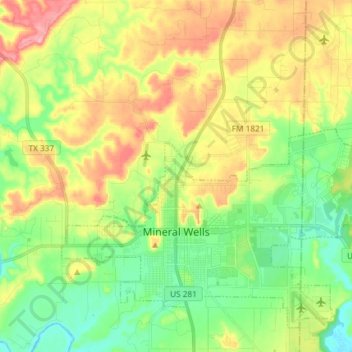
Name: Mineral Wells topographic map, elevation, terrain.
Location: Mineral Wells, Palo Pinto County, Texas, United States (32.77476 -98.16078 32.88142 -98.01363)
Average elevation: 965 ft
Minimum elevation: 787 ft
Maximum elevation: 1,227 ft
Palo Pinto County trails, hiking, mountain biking, running and outdoor activities
Other topographic maps
Click on a map to view its topography, its elevation and its terrain.