
Badin Lake topographic map
Interactive map
Click on the map to display elevation.
About this map
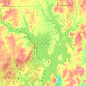
Name: Badin Lake topographic map, elevation, terrain.
Location: Badin Lake, Stanly County, North Carolina, United States (35.40774 -80.17705 35.51192 -80.06255)
Average elevation: 597 ft
Minimum elevation: 338 ft
Maximum elevation: 856 ft
Stanly County trails, hiking, mountain biking, running and outdoor activities
Other topographic maps
Click on a map to view its topography, its elevation and its terrain.