
Wake Forest topographic map
Interactive map
Click on the map to display elevation.
Wake Forest
Wake Forest is located in the northeast-central region of North Carolina, where the North American Piedmont and Atlantic Coastal Plain regions meet. This area is known as the "Fall Line" because it marks the elevation inland at which waterfalls begin to appear in creeks and rivers. Its central Piedmont location situates Wake Forest approximately three hours by car west of Atlantic Beach, and four hours east of the Great Smoky Mountains.
About this map
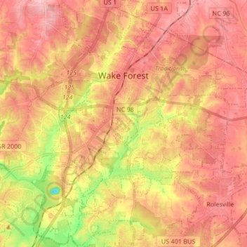
Name: Wake Forest topographic map, elevation, terrain.
Location: Wake Forest, Wake County, North Carolina, United States (35.90430 -78.55946 36.01376 -78.44236)
Average elevation: 344 ft
Minimum elevation: 59 ft
Maximum elevation: 502 ft
Wake County trails, hiking, mountain biking, running and outdoor activities
Other topographic maps
Click on a map to view its topography, its elevation and its terrain.
Prestonwood Soccer Complex
United States > North Carolina > Wake County > Cary
Average elevation: 364 ft