
McKenzie County topographic map
Interactive map
Click on the map to display elevation.
About this map
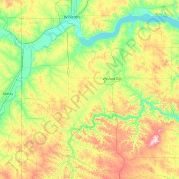
Name: McKenzie County topographic map, elevation, terrain.
Location: McKenzie County, North Dakota, United States (47.32827 -104.04533 48.14669 -102.54937)
Average elevation: 2,234 ft
Minimum elevation: 1,824 ft
Maximum elevation: 3,274 ft
North Dakota trails, hiking, mountain biking, running and outdoor activities
Other topographic maps
Click on a map to view its topography, its elevation and its terrain.
North Salt Lake State Game Management Area
United States > North Dakota > Walsh County
Average elevation: 823 ft