Geolocate

Boxford topographic maps

Click on a map to view its topography, its elevation and its terrain.
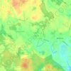
East Parish

United States > Massachusetts > Essex County > Boxford

Average elevation: 125 ft

Gear up for your next adventure:

🪶Camping Sleeping Pad - Comfortable sleeping pad for backpacking
🔦Compact Flashlight - Reliable flashlight for emergencies
🗺️NatGeo Topo Maps - High-quality waterproof printed topographic maps of US Parks
👟Men's Trail Runners - Lightweight footwear for fast-paced exploration and light hiking
🖼️Topo Map Wall Art - Decorative topographic prints of famous peaks and regions

As an Amazon Associate, this site earns from qualifying purchases at no extra cost to you.