Geolocate

Erharting topographic maps

Click on a map to view its topography, its elevation and its terrain.
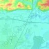
Frixing

Germany > Bavaria > Landkreis Mühldorf am Inn > Erharting

Average elevation: 1,352 ft

Gear up for your next adventure:

🏫Relief Map Kits - Hands-on tools for teaching landforms and elevation
🏕️Tent Footprint - Protect your tent base from wear
🥄Camping Utensil Set - Lightweight utensils for outdoor meals
🪶LED Camping Lantern - Bright lantern for camp lighting
🩹Survival Bandages - High‑quality bandages for emergencies

As an Amazon Associate, this site earns from qualifying purchases at no extra cost to you.