Geolocate

St. George topographic maps

Click on a map to view its topography, its elevation and its terrain.
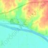
Saint George

United States > Kansas > Pottawatomie County > St. George

Average elevation: 1,056 ft

Gear up for your next adventure:

🏕️Tent Footprint - Protect your tent base from wear
🛰️Handheld GPS Units - Professional satellite navigators for precise backcountry mapping
🌧️Backpack Rain Cover - Keep gear dry in wet weather
🧭Map Reading Tools - Tools and kits for map navigation
🥘Titanium Cookware - Durable, featherlight pots and pans for backpacking

As an Amazon Associate, this site earns from qualifying purchases at no extra cost to you.