Geolocate

Chilca topographic maps

Click on a map to view its topography, its elevation and its terrain.
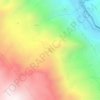
Laguna Wilcacocha

Perú > Áncash > Huaraz > Chilca

Average elevation: 11,867 ft

Gear up for your next adventure:

📻Weather Alert Radios - Stay informed of storm risks while off-the-grid
📡Handheld GPS Device - Reliable handheld GPS for outdoor navigation
🦶Carbon Trekking Poles - Reduce knee impact on steep descents with ultra-light poles
🧭Outdoor Navigation Book - Learn advanced navigation skills
🔊Portable Camp Speaker - Music and alerts at camp

As an Amazon Associate, this site earns from qualifying purchases at no extra cost to you.