Geolocate

Santa Rita topographic maps

Click on a map to view its topography, its elevation and its terrain.
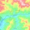
Santa Rita

Honduras > Copán > Santa Rita

Average elevation: 2,815 ft

Gear up for your next adventure:

🥾Men's Hiking Boots - Durable, waterproof footwear for rugged terrain and steep inclines
🎒Outdoor Daypacks - Lightweight backpacks designed for carrying maps and essential gear
🗻Climbing Gear Basics - Essential gear for beginner climbers
☕Camping Coffee Makers - Enjoy premium coffee at the summit or campsite
🥤Water Filter Bottle - All‑in‑one filter bottle for safe hydration

As an Amazon Associate, this site earns from qualifying purchases at no extra cost to you.