Geolocate

Faaa topographic maps

Click on a map to view its topography, its elevation and its terrain.
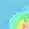
Faa'a

France > French Polynesia > Faaa

Average elevation: 269 ft

Gear up for your next adventure:

🔭Telescopic Hiking Pole - Adjustable pole for hiking stability
🏫Relief Map Kits - Hands-on tools for teaching landforms and elevation
📶Vehicle Signal Boosters - Improve reception in rural areas while driving to trailheads
🗺️Topographic Maps - Detailed topo maps for hiking, exploring and outdoor navigation
☀️Outdoor Sunscreen - High protection sunscreen for outdoor activities

As an Amazon Associate, this site earns from qualifying purchases at no extra cost to you.