Geolocate

Isabela topographic maps

Click on a map to view its topography, its elevation and its terrain.
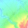
Bi-ao

Philippines > Negros Occidental > Isabela

Average elevation: 541 ft

Gear up for your next adventure:

🗺️NatGeo Topo Maps - High-quality waterproof printed topographic maps of US Parks
🔥Plasma Lighters - Windproof lighters that work in any weather condition
📱Solar Portable Charger - Solar power bank for charging devices off‑grid
🔌USB Car Charger - Car charger for on‑the‑go power needs
📻Weather Alert Radios - Stay informed of storm risks while off-the-grid

As an Amazon Associate, this site earns from qualifying purchases at no extra cost to you.