Geolocate

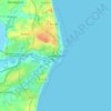
Lowestoft topographic maps

Click on a map to view its topography, its elevation and its terrain.

Lowestoft

United Kingdom > England > Lowestoft

Average elevation: 16 ft

Gear up for your next adventure:

🧯Portable Fire Pit - Compact fire pit for camping spots
📚Navigation Handbooks - Master the art of reading topographic maps and using a compass
🧭Orienteering Set - Complete compass and map reading kit
🔋Solar Power Banks - Keep your GPS and phone charged in remote wilderness areas
🛡️Insect Repellent - Protection against bugs during outdoor activities

As an Amazon Associate, this site earns from qualifying purchases at no extra cost to you.