Geolocate

Tiranges topographic maps

Click on a map to view its topography, its elevation and its terrain.
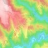
Châles

France > Auvergne-Rhône-Alpes > Haute-Loire > Tiranges

Average elevation: 2,267 ft

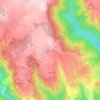
Cerces

France > Auvergne-Rhône-Alpes > Haute-Loire > Tiranges

Average elevation: 2,707 ft

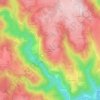
Les Arnauds

France > Auvergne-Rhône-Alpes > Haute-Loire > Tiranges

Average elevation: 2,575 ft

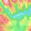
Le Plot

France > Auvergne-Rhône-Alpes > Haute-Loire > Tiranges

Average elevation: 2,198 ft

Moulas

France > Auvergne-Rhône-Alpes > Haute-Loire > Tiranges

Average elevation: 2,313 ft

Le Bec

France > Auvergne-Rhône-Alpes > Haute-Loire > Tiranges

Average elevation: 2,743 ft

Gear up for your next adventure:

📚Navigation Handbooks - Master the art of reading topographic maps and using a compass
🧦Hiking Socks - Comfortable socks to prevent blisters on long hikes
🛠️Outdoor Gear Repair Kit - Essential tools to fix gear on the trail
🪶Trail Camera - Capture wildlife on your hikes
🍳Camping Cook Set - Complete cookware for outdoor meals

As an Amazon Associate, this site earns from qualifying purchases at no extra cost to you.