Geolocate

Nazareth topographic maps

Click on a map to view its topography, its elevation and its terrain.
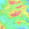
Nazareth

Israel > North District > Nazareth

As of the early 1990s, no city plans drafted by Nazareth Municipality have been approved by the government (both the British Mandate and later Israel) since 1942. This has left many people in Nazareth who vote in the city's municipal elections and receive services from its municipality effectively outside of…

Average elevation: 495 ft

Gear up for your next adventure:

🥾Women's Hiking Boots - Top-rated trail boots with ankle support and superior grip
🧭Hiking Compass - Precision compass for reliable navigation in the wilderness
🔦Compact Flashlight - Reliable flashlight for emergencies
🥘Titanium Cookware - Durable, featherlight pots and pans for backpacking
🌲Outdoor Survival Books - Best books on survival skills

As an Amazon Associate, this site earns from qualifying purchases at no extra cost to you.