Geolocate

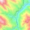
Tapo topographic maps

Click on a map to view its topography, its elevation and its terrain.

Maco

Peru > Junín > Tapo

Average elevation: 12,487 ft

Gear up for your next adventure:

🥘Titanium Cookware - Durable, featherlight pots and pans for backpacking
🧢Outdoor Hiking Hat - Sun protection hat for outdoor explorers
🛰️Handheld GPS Units - Professional satellite navigators for precise backcountry mapping
🧥Waterproof Jacket for Hiking - Breathable and rugged rain jacket for outdoor excursions
🚗GPS Dash Cams - Record your scenic drives through mountain passes and canyons

As an Amazon Associate, this site earns from qualifying purchases at no extra cost to you.