Geolocate

Escorca topographic maps

Click on a map to view its topography, its elevation and its terrain.
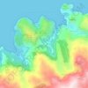
sa Calobra

Spain > Balearic Islands > Serra de Tramuntana > Escorca

The port village is a popular destination for coach trips and road cyclists. It is accessed by a single winding road, designed by Italian-Spanish engineer Antonio Parietti and opened in 1933, which features many hairpin bends and a 270° spiral bridge called the tie knot. The climb is officially called the…

Average elevation: 840 ft

Gear up for your next adventure:

🔭Stargazing Telescopes - Perfect for camping in low-light pollution areas shown on maps
📖Nature Tracking Books - Learn to track wildlife and terrain
🧥Waterproof Jacket for Hiking - Breathable and rugged rain jacket for outdoor excursions
🔥Fast-Boil Camping Stoves - Efficient cooking systems for quick trail meals
💧Water Filtration Bottles - Safely drink from streams and lakes while exploring

As an Amazon Associate, this site earns from qualifying purchases at no extra cost to you.