Geolocate

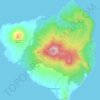
Calayan topographic maps

Click on a map to view its topography, its elevation and its terrain.

Dalupiri

Philippines > Cagayan > Calayan

Average elevation: 666 ft

Mount Pangasun

Philippines > Cagayan > Calayan

Babuyan Claro is a stratovolcano with an elevation of 843 meters (2,766 ft) and a base diameter of about 8 kilometers (5.0 mi) located in the center of Babuyan Island (also referred to as Babuyan Claro Island). It has four morphologically-fresh volcanic edifices: Mt. Cayonan in the south, Mt. Naydi and Mt.…

Average elevation: 2,257 ft

Didicas Volcano

Philippines > Cagayan > Calayan

Didicas is topped with a lava dome with an elevation of 228 metres (748 ft) and a base diameter of 1,200 metres (3,900 ft) at sea level. It is at the southern end of the Luzon Volcanic Arc, and like all the volcanoes in the Philippines, is part of the Pacific ring of fire.

Average elevation: 23 ft

Sibang Cove

Philippines > Cagayan > Calayan > Dadao

Average elevation: 184 ft

Dibay

Philippines > Cagayan > Calayan

Average elevation: 89 ft

Centro I

Philippines > Cagayan > Calayan

Average elevation: 62 ft

Magsidel

Philippines > Cagayan > Calayan

Average elevation: 344 ft

Mount Babuyan

Philippines > Cagayan > Calayan

Average elevation: 682 ft

Babuyan Island

Philippines > Cagayan > Calayan

Average elevation: 607 ft

Centro II

Philippines > Cagayan > Calayan

Average elevation: 164 ft

About this place

Gear up for your next adventure:

🎒Gear Packing Cubes - Organize your backpack efficiently
🥾Women's Hiking Boots - Top-rated trail boots with ankle support and superior grip
🔌USB Car Charger - Car charger for on‑the‑go power needs
🕶️Glacier Sunglasses - Side shields to protect eyes from high-altitude snow glare
🏕️Tent Footprint - Protect your tent base from wear

As an Amazon Associate, this site earns from qualifying purchases at no extra cost to you.