

Libya topographic maps
Click on a map to view its topography, its elevation and its terrain.
Benghazi
The largest Ottoman architectural monument in Benghazi is the late 19th-century Ottoman palace in El-Berka; built during the rule of Rashid Pasha II. The front elevation was completed in 1895, whilst the side sections were added later during Italian rule. The white and green structure houses 360 rooms; and is…
Average elevation: 75 ft
Derna
Libya has mostly a flat undulating plain and occasional plateau, with an average elevation of around 423 m (1,388 ft). Around 91 per cent of the land is covered by desert, with only 8.8 per cent agricultural land (with only 1% arable lands) and 0.1 per cent of forests. The major resources are petroleum, gypsum…
Average elevation: 515 ft

Libyan Desert
Sand plains, dunes, ridges, and some depressions (basins) typify the endorheic region, with no rivers draining into or out of the desert. The Gilf Kebir plateau reaches an altitude of just over 1,000 m (3,300 feet), and along with the nearby massif of Jebel Uweinat is an exception to the uninterrupted…
Average elevation: 1,857 ft
Marj
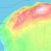
Libya has mostly a flat undulating plain and occasional plateau, with an average elevation of around 423 m (1,388 ft). Around 91 per cent of the land is covered by desert, with only 8.8 per cent agricultural land (with only 1% arable lands) and 0.1 per cent of forests. The major resources are petroleum, gypsum…
Average elevation: 627 ft





Sirte
The boundaries of Sirte district have changed several times, most recently in the 2007 administrative reorganization of Libyan districts (see maps). From 1983 to 1987 the Bin Jawad District covered parts of what is now part of Sirte District. To the north, Sirte District has a shoreline on the Mediterranean…
Average elevation: 531 ft




Jabal al Gharbi
Libya has mostly a flat undulating plain and occasional plateau, with an average elevation of around 423 m (1,388 ft). Around 91 per cent of the land is covered by desert, with only 8.8 per cent agricultural land (with only 1% arable lands) and 0.1 per cent of forests. The major resources are petroleum, gypsum…
Average elevation: 1,480 ft





Wadi al Hayaa
The district is bordered by Wadi al Shatii in north, Sabha in east, Murzuq in south and Ghat in the west. The district is part of Fezzen geographical division of Libya which is mostly desert. The region receives an annual rainfall of 2.5 in (64 mm). There are no perennial rivers in the region, but the region…
Average elevation: 1,870 ft


