Geolocate

Mérida topographic maps

Click on a map to view its topography, its elevation and its terrain.
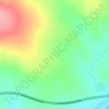
Esparraguera

España > Extremadura > Mérida

Average elevation: 919 ft

Castañar

España > Extremadura > Mérida

Average elevation: 853 ft

La Isla

España > Extremadura > Mérida

Average elevation: 719 ft

Río Guadiana

España > Extremadura > Mérida

Una de sus múltiples fuentes, la que le otorga su nombre, se configura en la provincia española de Ciudad Real, en el manantial de los Ojos del Guadiana, situado en el término municipal de Villarrubia de los Ojos, a 608 m de altitud. Uno de los ríos que fluyen en su cabecera es el Guadiana Viejo,…

Average elevation: 728 ft
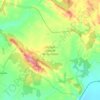
Parque Natural de Cornalvo

España > Extremadura > Mérida

Average elevation: 1,079 ft

Distrito 6

España > Extremadura > Mérida

Average elevation: 732 ft

Gear up for your next adventure:

🎒Day Hiking Backpack - Lightweight backpack perfect for day trips and outdoor adventures
📷Action Camera - Capture your outdoor adventures in HD
🪄Magnetic Compass - Accurate compass for navigation
🧯Portable Fire Pit - Compact fire pit for camping spots
🛌Ultralight Sleeping Bags - Compact down bags for cold nights in the wilderness

As an Amazon Associate, this site earns from qualifying purchases at no extra cost to you.