Geolocate

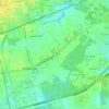
Brookside topographic maps

Click on a map to view its topography, its elevation and its terrain.

Deer Run

United States > Delaware > New Castle County > Brookside

Average elevation: 62 ft

Gear up for your next adventure:

📡Handheld GPS Device - Reliable handheld GPS for outdoor navigation
🧷Carabiner Set - Durable clips for gear attachment
👖Convertible Hiking Pants - Versatile zip-off pants for changing altitudes and temperatures
🖼️Topo Map Wall Art - Decorative topographic prints of famous peaks and regions
🏔️Mountain Trail Maps - High‑detail maps for popular peaks

As an Amazon Associate, this site earns from qualifying purchases at no extra cost to you.