Geolocate

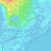
Frontignan topographic maps

Click on a map to view its topography, its elevation and its terrain.

La Peyrade

France > Occitanie > Hérault > Frontignan

Average elevation: 20 ft

Frontignan Plage

France > Occitanie > Hérault > Frontignan

Average elevation: -3 ft

Les Aresquiers

France > Occitanie > Hérault > Frontignan

Average elevation: 0 ft

Gear up for your next adventure:

🌐World Map Poster - Decorative world maps with topographic info
🪶Compact Camp Shovel - Folding shovel for campsite tasks
🥘Titanium Cookware - Durable, featherlight pots and pans for backpacking
🦶Carbon Trekking Poles - Reduce knee impact on steep descents with ultra-light poles
🔦Compact Flashlight - Reliable flashlight for emergencies

As an Amazon Associate, this site earns from qualifying purchases at no extra cost to you.