

Hattem topographic maps
Click on a map to view its topography, its elevation and its terrain.
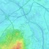
Hattem
Nederland > Gelderland > Hattem
Vijf banen van blauw en geel in de verhouding 1:1:4:1:1, met op de middelste baan een gele mispelbloem. Verhouding hoogte:lengte vlag = 2:3. Er is gebruikgemaakt van de kleuren van het Gelders wapen die ook terug zijn te vinden in het stadswapen. Mispelbloem: de wapenfiguur uit het oudste Gelderse wapen.…
Average elevation: 23 ft