Geolocate

Trumbull topographic maps

Click on a map to view its topography, its elevation and its terrain.
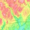
Trumbull

USA > Connecticut > Trumbull

Average elevation: 312 ft

Gear up for your next adventure:

🚗GPS Dash Cams - Record your scenic drives through mountain passes and canyons
🔋Solar Power Banks - Keep your GPS and phone charged in remote wilderness areas
🛶Inflatable Kayak - Portable kayak for rivers, lakes, and expeditions
🧺Microfiber Travel Towels - Compact and fast-drying towels for trail use
⛺Backpacking Tents - Weight-optimized shelters for multi-day topographic surveys

As an Amazon Associate, this site earns from qualifying purchases at no extra cost to you.