Geolocate

Pomfret topographic maps

Click on a map to view its topography, its elevation and its terrain.
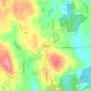
Pomfret

USA > Connecticut > Pomfret

Average elevation: 509 ft

Gear up for your next adventure:

🌡️Handheld Weather Meters - Measure wind, temp, and pressure for safe mountain travel
🏔️Mountain Trail Maps - High‑detail maps for popular peaks
🧺Microfiber Travel Towels - Compact and fast-drying towels for trail use
🧯Portable Fire Pit - Compact fire pit for camping spots
🧤Tactile Hiking Gloves - Keep hands warm while operating GPS and smartphone screens

As an Amazon Associate, this site earns from qualifying purchases at no extra cost to you.