Geolocate

Poissy topographic maps

Click on a map to view its topography, its elevation and its terrain.
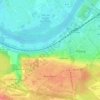
Parc Meissonier

France > Île-de-France > Yvelines > Poissy

Average elevation: 144 ft

Gear up for your next adventure:

🔪Outdoor Multitools - Essential survival tools for gear repair and field use
🪓Survival Multi‑Tool - Versatile tool for camp and trail tasks
📚Navigation Handbooks - Master the art of reading topographic maps and using a compass
🗻Climbing Gear Basics - Essential gear for beginner climbers
🔦Compact Flashlight - Reliable flashlight for emergencies

As an Amazon Associate, this site earns from qualifying purchases at no extra cost to you.