Geolocate

Villing topographic maps

Click on a map to view its topography, its elevation and its terrain.
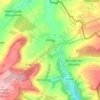
Trois Maisons

France > Grand Est > Moselle > Villing

Average elevation: 971 ft

Gear up for your next adventure:

🏔️Mountain Trail Maps - High‑detail maps for popular peaks
🧭Outdoor Navigation Book - Learn advanced navigation skills
🪶Compact Camp Shovel - Folding shovel for campsite tasks
📱Heavy-Duty Phone Cases - Drop-proof and waterproof protection for outdoor navigation
⌚Solar GPS Watches - Advanced multisport watches with built-in topographic maps

As an Amazon Associate, this site earns from qualifying purchases at no extra cost to you.