Geolocate

Woking topographic maps

Click on a map to view its topography, its elevation and its terrain.
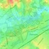
Durnford Farm

United Kingdom > England > Surrey > Woking > Woking

Average elevation: 102 ft

Gear up for your next adventure:

🎁Geography Themed Gifts - Unique gift ideas for map lovers and geography enthusiasts
📶Satellite Messenger - Communication device off‑grid
📚USA Hiking Guide Books - Top trail guides and map books
📌Outdoor GPS Map App - Apps and devices for digital topographic navigation
🧥Men's Rain Shells - Premium waterproof and breathable jackets for mountain weather

As an Amazon Associate, this site earns from qualifying purchases at no extra cost to you.