Geolocate

Casinglot topographic maps

Click on a map to view its topography, its elevation and its terrain.
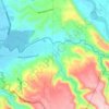
Alae River

Philippines > Misamis Oriental > Casinglot

Average elevation: 351 ft

Gear up for your next adventure:

🏔️Mountain Trail Maps - High‑detail maps for popular peaks
👓Polarized Sunglasses - Outdoor sunglasses for glare reduction
🛶Inflatable Kayak - Portable kayak for rivers, lakes, and expeditions
🩹Survival Bandages - High‑quality bandages for emergencies
🏕️Tent Footprint - Protect your tent base from wear

As an Amazon Associate, this site earns from qualifying purchases at no extra cost to you.