Geolocate

Killylea topographic maps

Click on a map to view its topography, its elevation and its terrain.
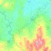
Armagh

United Kingdom > Northern Ireland > County Armagh > Killylea

Average elevation: 328 ft

Gear up for your next adventure:

💧Water Filtration Bottles - Safely drink from streams and lakes while exploring
🧭Pro Hiking Compasses - High-accuracy liquid-filled compasses for topographic orientation
🥩Freeze-Dried Meals - Nutritious and lightweight food for remote expeditions
🪓Survival Multi‑Tool - Versatile tool for camp and trail tasks
☀️Outdoor Sunscreen - High protection sunscreen for outdoor activities

As an Amazon Associate, this site earns from qualifying purchases at no extra cost to you.