Geolocate

Domprix topographic maps

Click on a map to view its topography, its elevation and its terrain.
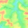
Les Aubussons

France > Grand Est > Meurthe-et-Moselle > Domprix

Average elevation: 948 ft

Gear up for your next adventure:

🏔️Mountain Trail Maps - High‑detail maps for popular peaks
⛺Backpacking Tents - Weight-optimized shelters for multi-day topographic surveys
🥇GPS Hiking Watch - Multi‑sport GPS watch with navigation and trail tracking
🧥Waterproof Jacket for Hiking - Breathable and rugged rain jacket for outdoor excursions
🥩Freeze-Dried Meals - Nutritious and lightweight food for remote expeditions

As an Amazon Associate, this site earns from qualifying purchases at no extra cost to you.