Geolocate

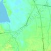
Simaron topographic maps

Click on a map to view its topography, its elevation and its terrain.

Simaron

Philippines > Oriental Mindoro > Bayanan II > Simaron

Average elevation: 20 ft

Gear up for your next adventure:

🌧️Backpack Rain Cover - Keep gear dry in wet weather
📡Handheld GPS Device - Reliable handheld GPS for outdoor navigation
🧭Compass with Lanyard - Easy‑carry compass for navigation
⛺Backpacking Tents - Weight-optimized shelters for multi-day topographic surveys
🧢Sun Protection Hats - Wide-brimmed and UPF-rated hats for high-altitude sun safety

As an Amazon Associate, this site earns from qualifying purchases at no extra cost to you.