Geolocate

Sparkwell topographic maps

Click on a map to view its topography, its elevation and its terrain.
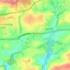
Smithaleigh

United Kingdom > England > Devon > South Hams > Sparkwell

Average elevation: 259 ft

Gear up for your next adventure:

🌐World Map Poster - Decorative world maps with topographic info
🥾Men's Hiking Boots - Durable, waterproof footwear for rugged terrain and steep inclines
📱Solar Portable Charger - Solar power bank for charging devices off‑grid
🔊Portable Camp Speaker - Music and alerts at camp
🥩Freeze-Dried Meals - Nutritious and lightweight food for remote expeditions

As an Amazon Associate, this site earns from qualifying purchases at no extra cost to you.