Geolocate

Nevers topographic maps

Click on a map to view its topography, its elevation and its terrain.
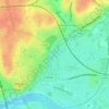
La Nièvre

France > Bourgogne – Franche-Comté > Nièvre > Nevers

Average elevation: 617 ft

Gear up for your next adventure:

🌡️Portable Weather Meter - Track weather conditions on the trail
🖼️Topo Map Wall Art - Decorative topographic prints of famous peaks and regions
🔊Portable Camp Speaker - Music and alerts at camp
🩳Quick‑Dry Hiking Shorts - Comfortable and quick‑dry shorts for summer hiking
🪑Ultralight Camp Chairs - Portable seating for resting after a long day of mapping

As an Amazon Associate, this site earns from qualifying purchases at no extra cost to you.