Geolocate

Intihuatana topographic maps

Click on a map to view its topography, its elevation and its terrain.
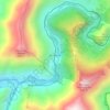
San Miguel

Peru > Cusco > Machupicchu > Intihuatana

Average elevation: 7,421 ft

Intipata

Peru > Cusco > Machupicchu > Intihuatana > San Miguel

Average elevation: 8,789 ft

About this place

Gear up for your next adventure:

🎒Waterproof Dry Bags - Keep your electronics and maps dry inside your pack
🔥Fast-Boil Camping Stoves - Efficient cooking systems for quick trail meals
🦶Carbon Trekking Poles - Reduce knee impact on steep descents with ultra-light poles
🪑Portable Camp Table - Compact table for campsite meals
💧Water Filtration Bottles - Safely drink from streams and lakes while exploring

As an Amazon Associate, this site earns from qualifying purchases at no extra cost to you.