Geolocate

Klima topographic maps

Click on a map to view its topography, its elevation and its terrain.
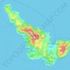
Skopelos

Greece > Thessaly > Sporades Regional Unit > Klima

The second largest settlement is Glossa village, situated on the northwestern tip of the island, just above Loutraki harbour, with an elevation ranging from 200 to 300 m (656 to 984 ft). It is 25.4 km (15.8 mi) from Skopelos town. It is a tranquil village with traditional houses, with 993 residents.

Average elevation: 194 ft

Gear up for your next adventure:

❄️Traction Cleats - Prevent slips on icy trails during winter hikes
Backpacking Tents - Weight-optimized shelters for multi-day topographic surveys
🥤Water Filter Bottle - All‑in‑one filter bottle for safe hydration
🔦Compact Flashlight - Reliable flashlight for emergencies
🧯Emergency Survival Kit - All‑in‑one survival essentials for the backcountry

As an Amazon Associate, this site earns from qualifying purchases at no extra cost to you.