Geolocate

Stanton topographic maps

Click on a map to view its topography, its elevation and its terrain.
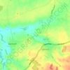
Stanton Chare

United Kingdom > England > Suffolk > West Suffolk > Stanton

Average elevation: 135 ft

Gear up for your next adventure:

🗺️NatGeo Topo Maps - High-quality waterproof printed topographic maps of US Parks
🧢Outdoor Hiking Hat - Sun protection hat for outdoor explorers
🧭Outdoor Navigation Book - Learn advanced navigation skills
📷Action Cameras - Rugged cameras to document your journeys across rugged terrain
🧯Emergency Survival Kit - All‑in‑one survival essentials for the backcountry

As an Amazon Associate, this site earns from qualifying purchases at no extra cost to you.