Geolocate

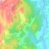
O Ribeiro topographic maps

Click on a map to view its topography, its elevation and its terrain.

Cenlle

Spain > Galicia > O Ribeiro

Average elevation: 810 ft

Leiro

Spain > Galicia > O Ribeiro

Average elevation: 1,007 ft

Berán

Spain > Galicia > O Ribeiro > Leiro

Average elevation: 797 ft

Carballeda de Avia

Spain > Galicia > O Ribeiro

Carballeda de Avia is a municipality in the province of Ourense, in the autonomous community of Galicia, Spain. It belongs to the comarca of O Ribeiro. It is located to the west of the province, 5.7 kilometres (3.5 mi) northwest of Ribadavia off the A-52 road. As of 2012 it had a population of 1487 people. It…

Average elevation: 1,135 ft

About this place

Gear up for your next adventure:

📦Dry Bags Set - Waterproof storage for electronics and clothes
🧭Compass with Lanyard - Easy‑carry compass for navigation
⛺Backpacking Tent - Lightweight and durable tent for multi‑day hikes
⌚Solar GPS Watches - Advanced multisport watches with built-in topographic maps
📌Outdoor GPS Map App - Apps and devices for digital topographic navigation

As an Amazon Associate, this site earns from qualifying purchases at no extra cost to you.