Geolocate

Heath topographic maps

Click on a map to view its topography, its elevation and its terrain.
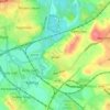
Heath

United Kingdom > England > Wakefield > Heath

Average elevation: 131 ft

Gear up for your next adventure:

💧Water Filtration Bottles - Safely drink from streams and lakes while exploring
🎒Outdoor Daypacks - Lightweight backpacks designed for carrying maps and essential gear
📡Handheld GPS Device - Reliable handheld GPS for outdoor navigation
🗺️NatGeo Topo Maps - High-quality waterproof printed topographic maps of US Parks
⛺Backpacking Tent - Lightweight and durable tent for multi‑day hikes

As an Amazon Associate, this site earns from qualifying purchases at no extra cost to you.