Geolocate

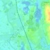
Rue topographic maps

Click on a map to view its topography, its elevation and its terrain.

Larronville

France > Hauts-de-France > Somme > Rue

Average elevation: 26 ft

80120

France > Hauts-de-France > Somme > Rue

Average elevation: 59 ft

Gear up for your next adventure:

🧭Pro Hiking Compasses - High-accuracy liquid-filled compasses for topographic orientation
📱Heavy-Duty Phone Cases - Drop-proof and waterproof protection for outdoor navigation
😴Insulated Sleeping Pads - Compact and warm pads for high-elevation camping
🧣Hiking Neck Gaiter - Multi‑use neck protection for outdoor weather
🏫Relief Map Kits - Hands-on tools for teaching landforms and elevation

As an Amazon Associate, this site earns from qualifying purchases at no extra cost to you.