Geolocate

Osa topographic maps

Click on a map to view its topography, its elevation and its terrain.
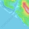
Dominical

Costa Rica > Puntarenas Province > Osa > Bahía Ballena

Average elevation: 220 ft

About this place

Gear up for your next adventure:

🧯Emergency Survival Kit - All‑in‑one survival essentials for the backcountry
🪶Trail Camera - Capture wildlife on your hikes
🖼️Topo Map Wall Art - Decorative topographic prints of famous peaks and regions
🧭Map Reading Tools - Tools and kits for map navigation
📷Action Cameras - Rugged cameras to document your journeys across rugged terrain

As an Amazon Associate, this site earns from qualifying purchases at no extra cost to you.