Geolocate

Ohrid topographic maps

Click on a map to view its topography, its elevation and its terrain.
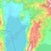
Ohrid

North Macedonia > Southwestern Region > Ohrid

Ohrid is located in the south-western part of North Macedonia, on the shore of Lake Ohrid, at an elevation of 695 meters above sea level.

Average elevation: 3,159 ft

Gear up for your next adventure:

🧣Merino Neck Gaiters - Multi-functional headwear for wind and sun protection
🏕️Family Camping Gear - Essentials for group camping trips
🕶️GPS Smartphone Mount - Secure mount for phone navigation
🧺Microfiber Travel Towels - Compact and fast-drying towels for trail use
🪶Fire Starter Kit - Reliable fire starter for survival and camping

As an Amazon Associate, this site earns from qualifying purchases at no extra cost to you.