Geolocate

Lyns topographic maps

Click on a map to view its topography, its elevation and its terrain.
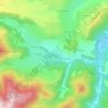
Lyns

France > Auvergne-Rhône-Alpes > Puy-de-Dôme > Saint-Diéry > Lyns

Average elevation: 2,451 ft

Gear up for your next adventure:

💧Water Filtration Bottles - Safely drink from streams and lakes while exploring
🧢Sun Protection Hats - Wide-brimmed and UPF-rated hats for high-altitude sun safety
🦶Carbon Trekking Poles - Reduce knee impact on steep descents with ultra-light poles
🧯Portable Fire Pit - Compact fire pit for camping spots
🚁Photography Drones - Capture stunning aerial views of landforms and topography

As an Amazon Associate, this site earns from qualifying purchases at no extra cost to you.