Geolocate

Retournac topographic maps

Click on a map to view its topography, its elevation and its terrain.
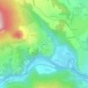
Le Corset

France > Auvergne-Rhône-Alpes > Haute-Loire > Retournac

Average elevation: 2,169 ft

Gear up for your next adventure:

🗺️Topographic Maps - Detailed topo maps for hiking, exploring and outdoor navigation
🏥Hiking First Aid Kits - Comprehensive medical kits for remote trail injuries
🧥Men's Rain Shells - Premium waterproof and breathable jackets for mountain weather
🪶Paracord Bracelet - Survival bracelet with built‑in tools
🧴Hand Sanitizer - Keep hands clean while hiking

As an Amazon Associate, this site earns from qualifying purchases at no extra cost to you.