Geolocate

Jessup topographic maps

Click on a map to view its topography, its elevation and its terrain.
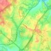
Springwood

United States > Maryland > Anne Arundel County > Jessup

Average elevation: 207 ft

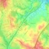
Jessup

United States > Maryland > Anne Arundel County > Jessup

Average elevation: 213 ft

Gear up for your next adventure:

🗺️Topographic Maps - Detailed topo maps for hiking, exploring and outdoor navigation
🍳Camping Cook Set - Complete cookware for outdoor meals
🪑Portable Camp Table - Compact table for campsite meals
☕Camping Coffee Makers - Enjoy premium coffee at the summit or campsite
🏫Relief Map Kits - Hands-on tools for teaching landforms and elevation

As an Amazon Associate, this site earns from qualifying purchases at no extra cost to you.