

Israel topographic maps
Click on a map to view its topography, its elevation and its terrain.
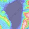
Sea of Galilee
The Sea of Galilee (Hebrew: יָם כִּנֶּרֶת, Judeo-Aramaic: יַמּא דטבריא, גִּנֵּיסַר, Arabic: بحيرة طبريا), also called Lake Tiberias or Kinneret, is a freshwater lake in Israel. It is the lowest freshwater lake on Earth and the second-lowest lake in the world (after…
Average elevation: -220 ft
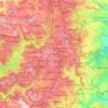
Jerusalem
Jerusalem occupies a rugged hilltop setting on a rocky spur within the Judaean Mountains, where the urban landscape rises around about 2,575 feet (785 m) above sea level and is shaped by a compact pattern of limestone ridges, saddles, slopes, and deeply incised dry valleys. The Old City and surrounding…
Average elevation: 2,208 ft

Shefaram
Shefa-Amr is located in the North District of Israel at the entrance to the Galilee. It is located 13 kilometres (8.1 mi) from the Mediterranean Sea and 20 kilometres (12 mi) from each of three cities, Haifa, Acre and Nazareth, where many of the inhabitants are employed. The city is located on seven hills,…
Average elevation: 410 ft

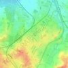

Tiberias
Tiberias is located on the shore of the Sea of Galilee and the western slopes of the Jordan Rift Valley overlooking the lake, in the elevation range of −200 to 200 metres (−660–660 feet). Tiberias has a climate that borders a Hot-summer Mediterranean climate (koppen Csa) and a Hot Semi-arid climate…
Average elevation: -157 ft