

Pachalik de Rabat topographic maps
Click on a map to view its topography, its elevation and its terrain.


Forêt urbaine Ibn Sina
Maroc > Rabat-Salé-Kénitra > Pachalik de Rabat > Rabat
Average elevation: 226 ft
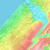
Rabat
Maroc > Rabat-Salé-Kénitra > Pachalik de Rabat
Située sur le littoral atlantique à l'embouchure du fleuve Bouregreg, la ville de Rabat présente une topographie variée mêlant façades maritimes abruptes et plateaux intérieurs doucement inclinés. Le relief se caractérise par une altitude moyenne d'environ 70 mètres, descendant jusqu’au niveau de…
Average elevation: 223 ft

